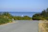
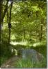
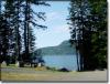
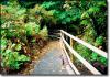
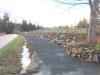
The rural areas of the Comox Valley Regional District (CVRD) are home to 65 parks to explore, in addition to 24 marked beach accesses. There are also many kilometres of maintained trails where horseback riders, cyclists, hikers and pet walkers can connect with the natural beauty of the Comox Valley.
Royston Seaside View Platform Closed
Updated December 5, 2023: The Royston Seaside viewing platform is closed until further notice due to structural issues.
Be sure to check out:
- Boat Launches: Bill Mee | Shingle Spit
- Dogs in Parks
- Nature Programs
- Park Rules & Permits
- Park Conditions
- Volunteering
- Community Parks and Greenways Analysis Report 2023
Search for a Park
Use the map to search for a park, or use the search fields below. Information on each park includes park features & amenities, historical information, trail maps and rules.

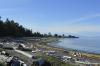
Anchor Road Beach Access
Electoral Area C (Puntledge Black Creek)Features: Beach, Panoramic views, Recreational trails, Scenic views, Waterfront, Wildlife viewing
Amenities: Parking, Road access
Argyle Road Beach Access
Electoral Area A (Baynes Sound- Denman/Hornby Islands)Features: Beach, Fishing, Panoramic views, Recreational trails, Scenic views, Waterfront, Wildlife viewing
Amenities: Road access, Roadside parking
Avonlee Greenway
Electoral Area B (Lazo North)Features: Forested trails, Greenway path, Recreational trails
Barbara Road Greenway
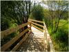
Electoral Area B (Lazo North)Features: Elevated boardwalk, Recreational trails
Bear Creek Nature Park
Electoral Area C (Puntledge Black Creek)Features: Forested trails, Recreational trails
Amenities: Access road
Bill Mee Park
Electoral Area A (Baynes Sound- Denman/Hornby Islands)Features: Boat launch, Fishing, Recreational trails, Waterfront, Wildlife viewing
Amenities: Outhouse, Parking lot, Picnic tables

Booth Road Beach Access
Electoral Area B (Lazo North)Features: Beach, Fishing, Panoramic views, Recreational trails, Scenic views, Waterfront, Wildlife viewing
Bracken Park
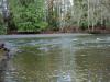
Electoral Area C (Puntledge Black Creek)Features: Forested trails, Recreational trails, Swimming, Waterfront
Brian and Sarah McLoughlin Park
Electoral Area C (Puntledge Black Creek)Features: Beach, Rare plants, Recreational trails, Trails, Wildlife viewing
Clam Shell Park
Electoral Area A (Baynes Sound- Denman/Hornby Islands)Features: Recreational trails, Waterfront, Wildlife viewing
Amenities: Parking

Cloudcroft Road Beach Access
Electoral Area C (Puntledge Black Creek)Features: Beach, Fishing, Panoramic views, Recreational trails, Scenic views, Wildlife viewing
Amenities: Roadside parking
Cosby Road Beach Access
Electoral Area C (Puntledge Black Creek)Features: Beach, Fishing, Panoramic views, Recreational trails, Roadside parking, Scenic views, Waterfront, Wildlife viewing
Amenities: Parking
Denman Cross Island Trail
Electoral Area A (Baynes Sound- Denman/Hornby Islands)Features: Recreational trails
Denny Road/Cattrall Way Beach Access
Features: Beach, Fishing, Panoramic views, Recreational trails, Waterfront, Wildlife viewing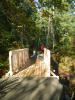
Driftwood Park
Electoral Area C (Puntledge Black Creek)Features: Forested trails, Recreational trails, Trails, Viewing platform, Wildlife viewing
Amenities: Parking lot, Roadside parking